
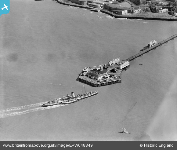
EPW048849 ENGLAND (1935). Margate Jetty pier-head, Margate, 1935
© Copyright OpenStreetMap contributors and licensed by the OpenStreetMap Foundation. 2024. Cartography is licensed as CC BY-SA.
Nearby Images (9)
EPW048849

EPW009163

EPW018601

EPW000634

EPW000619

EPW035467

EPW048851

EPW009240

EAW015840

Details
| Title | [EPW048849] Margate Jetty pier-head, Margate, 1935 |
| Reference | EPW048849 |
| Date | August-1935 |
| Link | |
| Place name | MARGATE |
| Parish | |
| District | |
| Country | ENGLAND |
| Easting / Northing | 635283, 171619 |
| Longitude / Latitude | 1.3825599374107, 51.394240930797 |
| National Grid Reference | TR353716 |
Pins
 mannidaze |
Sunday 14th of September 2014 07:38:15 PM |